Project information
- Category: Computer Vision / Remote Sensing and GIS
- Skills Used: Python, Random Forest, skimage, OpenCV, Image Processing
- Learn More at: Object-based image classification
Summary:
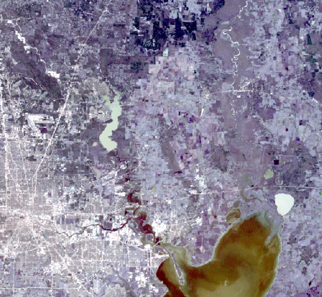
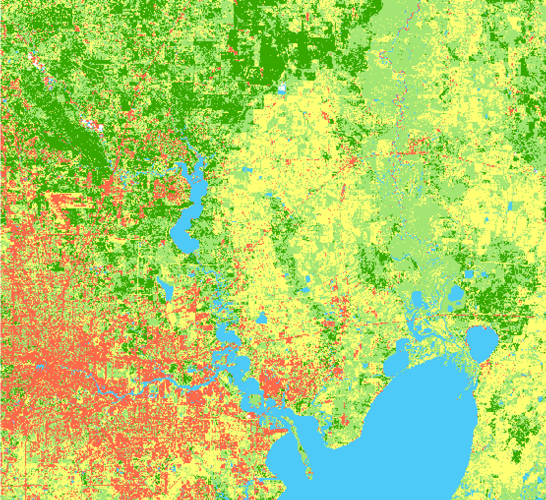
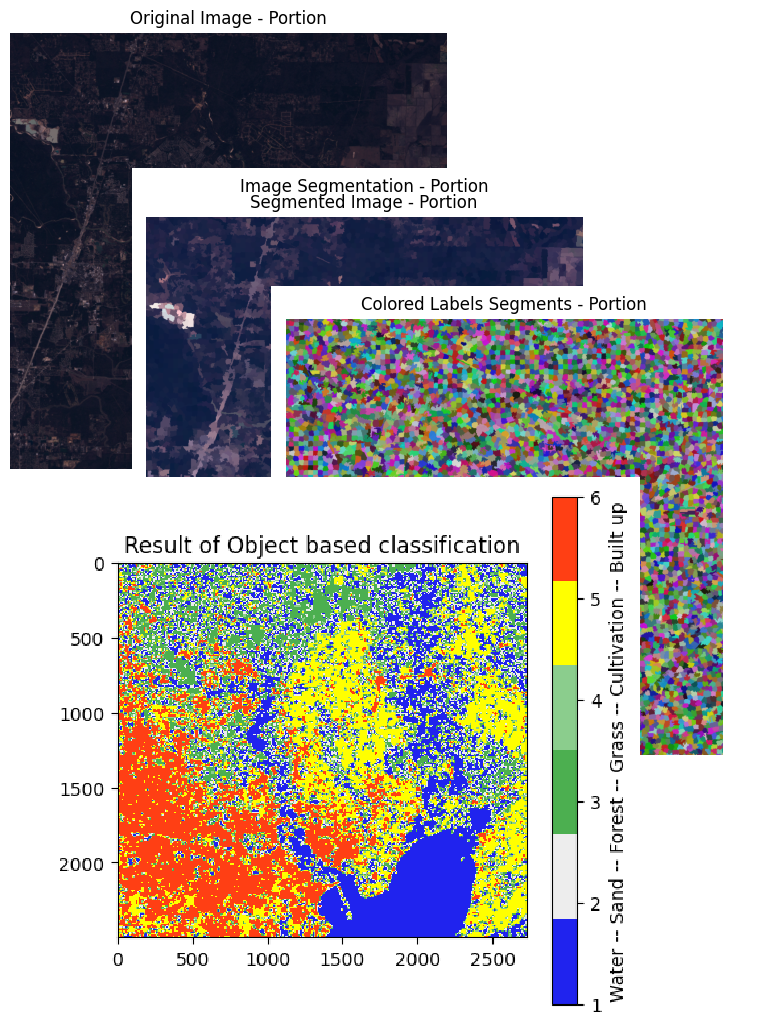
This is a tutorial for Object-based image classification (OBIC), which is a popular technique for analyzing satellite images, and involves grouping pixels into meaningful objects based on their spatial and spectral properties. OBIC has several advantages over traditional pixel-based classification, such as the ability to capture more complex patterns and to reduce the effects of noise and misclassification. In this article, we explored the basics of OBIC and its applications in satellite image analysis, with a focus on land use and land cover mapping. We used the scikit-image and other Python libraries to implement OBIC on real-world satellite imagery data. By the end of the article, readers should have a good understanding of OBIC and its potential for analyzing satellite imagery.