Project information
- Category: Computer Vision / GIS and Remote Sensing
- Skills Used: Python, TensorFlow, ArcGIS, Neural Network, Image Segmentation
- Learn More at: LULC Classification using ArcMap and Python
Summary:
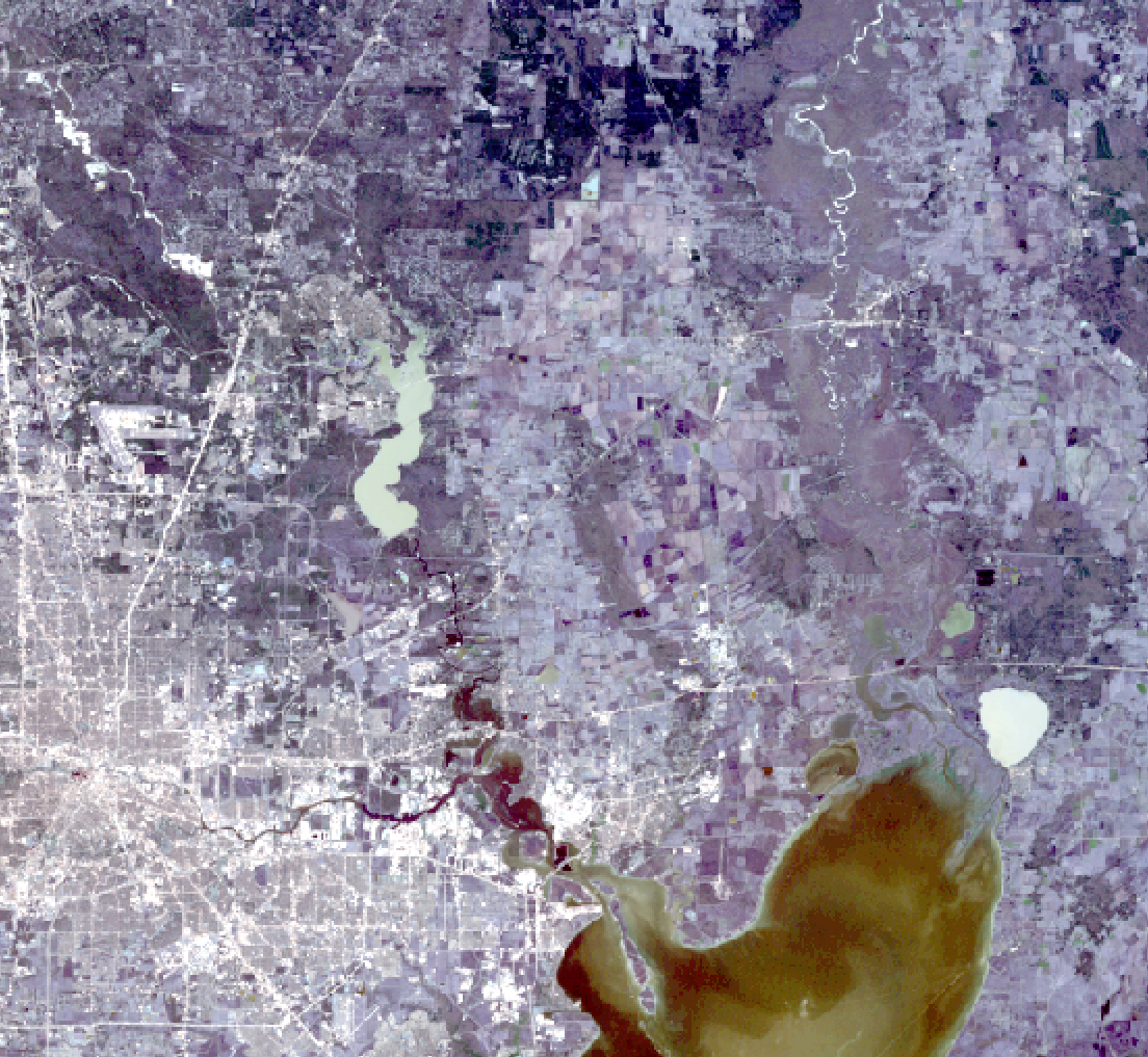
In this project, we used ArcMap to create training samples and to perform Maximum likelihood classification on a Landsat 8 scene.
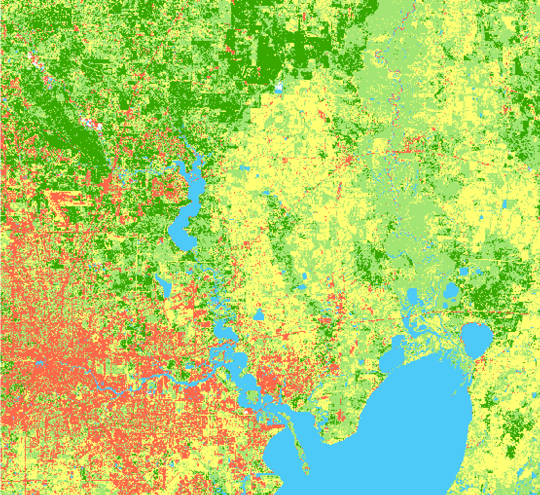
We then utilized TensorFlow in Python to create and train a neural network to classify the same scene.
The neural network was able to classify the scene with a higher accuracy than the Maximum likelihood classification method.
The Landsat 8 scene was first processed in ArcMap, where training samples were created
based on the spectral properties of the different land cover types in the scene.
Maximum likelihood classification was then performed to classify the scene based on the spectral signatures
of the training samples. However, the accuracy of the classification was limited by the quality of the training
samples and the assumptions made by the Maximum likelihood classification method.
To improve the accuracy of the classification, we then implemented a neural network using TensorFlow in Python.
The neural network was trained using the same Landsat 8 scene and the same training samples used in
the Maximum likelihood classification. The neural network was able to learn more complex relationships
between the spectral properties of the different land cover types, resulting in a more accurate classification.
Overall, the project demonstrated the potential of using machine learning techniques such as
neural networks to improve the accuracy of land cover classification from satellite imagery.