Project information
- Category: GIS Development
- Skills Used: Python, ArcGIS, Database Split, ArcPy
- Learn More at: ArcGIS Geodatabase Split Tool
Summary:
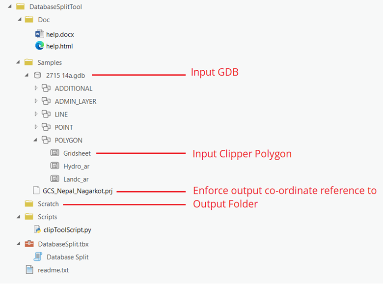
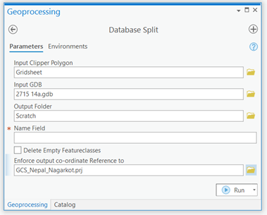
This tool takes a larger geodatabase along with a polygon feature class that will be used to clip the the geodatabase. It has options of whether or not to delete empty feature classes from output geodatabases. Also if the user wants the output geodatabases to be in a certain Coordinate Reference System, a .prj file for that CRS can be provided as input. This .prj file is optional. If no such file is provided or if the file is invalid, the feature datasets output geodatabases will follow the CRS of corresponding feature datasets from input geodatabase. It works only for feature datasets and Point, Line, Polygon and Annotation files.