Project information
- Category: GIS Development
- Skills Used: ArcMap, html, JavaScript, Python
- Source Code: GitHub: Time-enabled-mapping
- View it Live: US Population Throughout the Years
Summary:
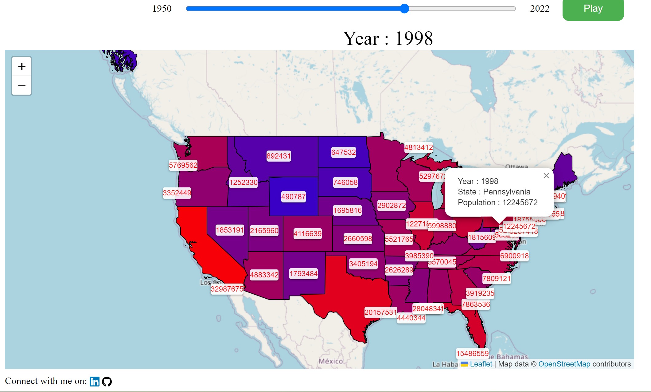
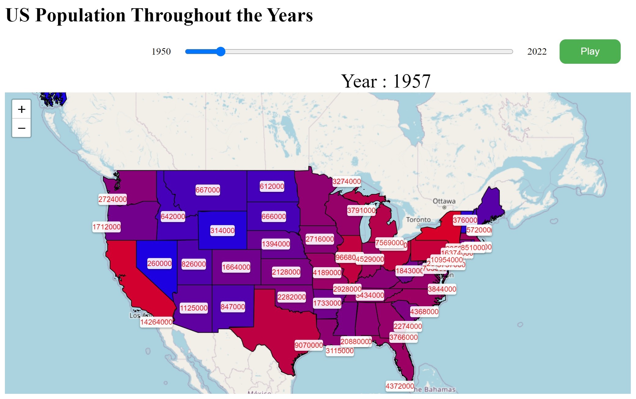
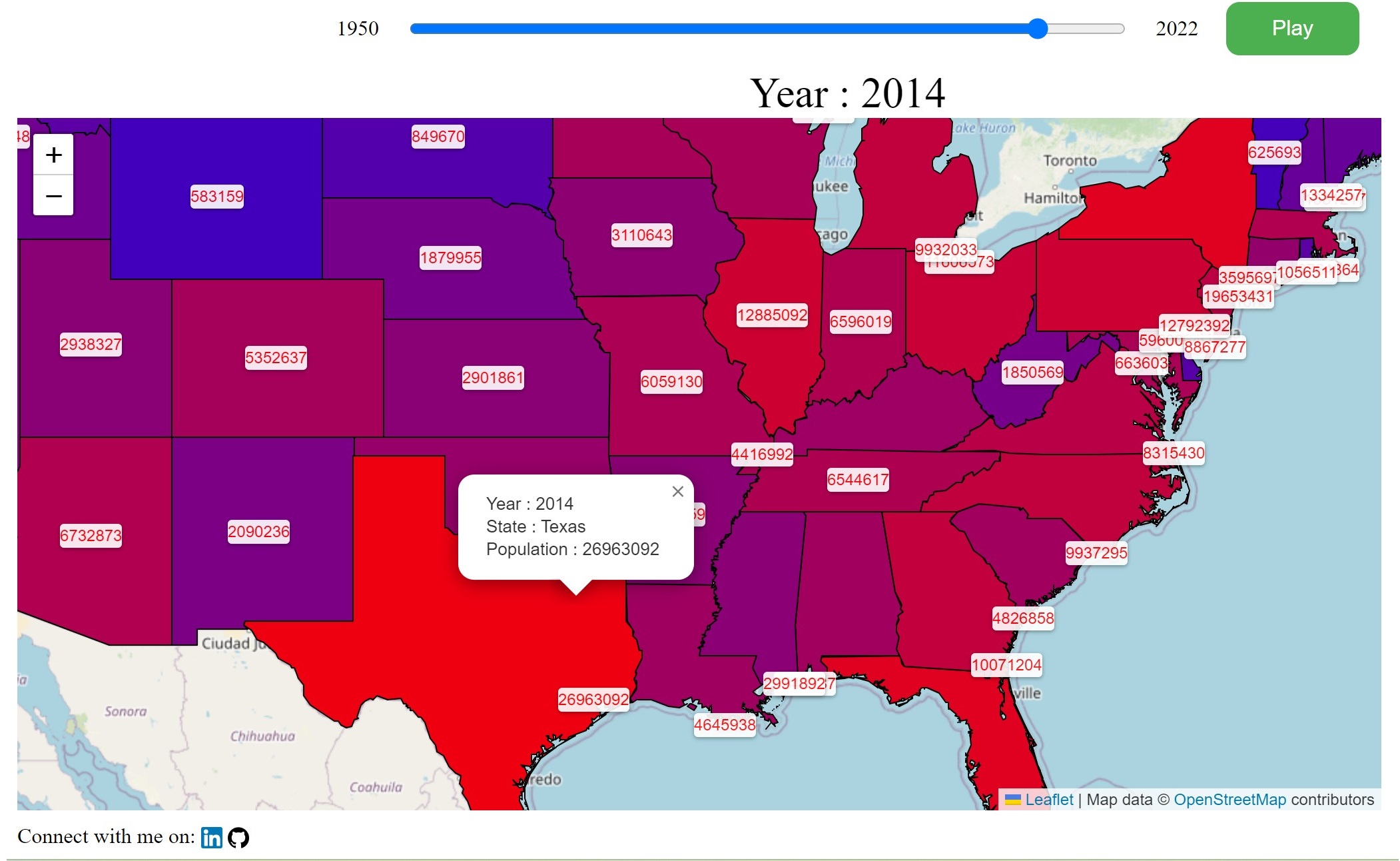
This is a time-enabled map of annual US states populations from 1950 to 2021.
Data was obtained from uasfacts website, in csv format, which was joined to US states polygons.
First the web-map was created using ArcMap by utilitng time-enabled layer, transposing the data from wide to long format, year extraction using field calculator,
addinng the lost states names via spatial join and exporting static maps for each year using python scripts.
These static images were converted to a basic dynamic maps using HTML and CSS, where based on the year selected by the user on time-slider, the displayed map
is updated. It also had a button to toggle pause/play of animation.
After this, a to created a truly dynamic web-map, a diffrent approch was taken, which used python simplifying the polygons, joining population data
to the polygons, and to export them as geojson file. The geojson file was uploaded to github, then using JavaScript, the file was read and extracted.
A leaflet map was created, where the States polygons are added, with labels and colors based on the year the user specified through an interactive time-slider
to create a choropleth map, where colors are porportinal to the population.
The map can be accessed at Us Population Throughout the Years