Project information
- Category: GIS Development
- Skills Used: Python, Streamlit, Cloud Deployement
- Source Code : SAM Segment Forest
- View Live at : Segment Forest Streamlit
Summary:
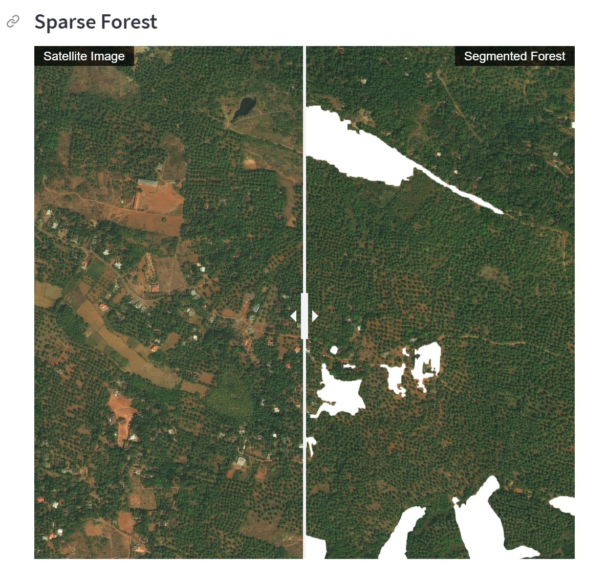
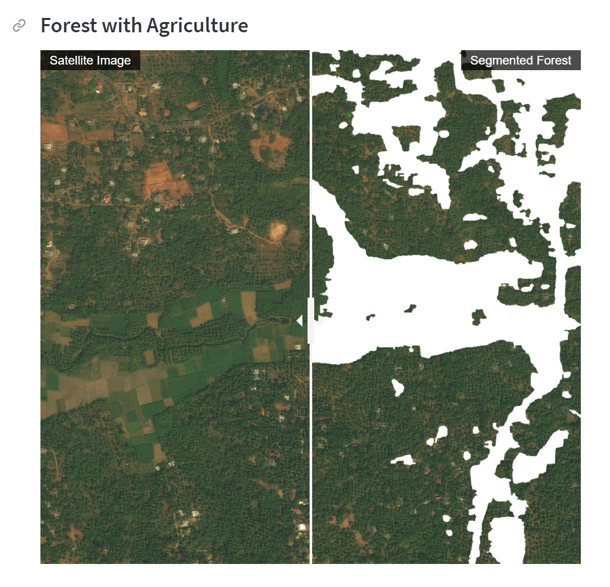
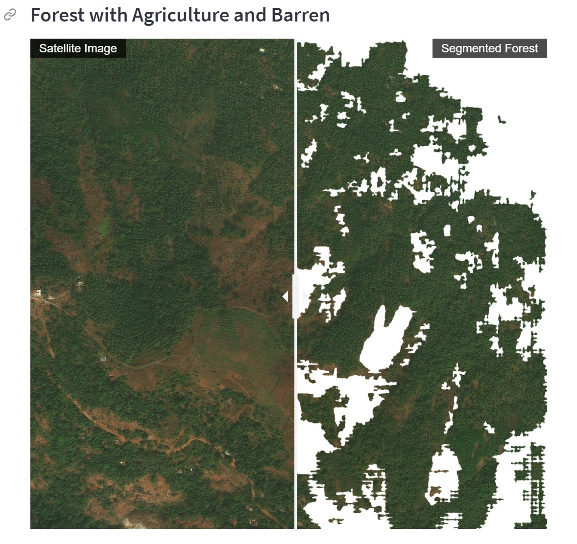
Segment Anything Model form Meta AI research group performs greatly for segmentation large water bodies and
buildings or in general images.
Having supervised a lot of manual image segmentation as well as done a lot of it myself,
I have found delineating the forest boundary to be a more challenging task for human labelers and
often there is inconsistency among masks created by different labelers.
Finding the boundary where the forest ends and other classes such as bush or grass or agricultural land start
is tricky due to the non-homogeneous nature of the forest surface in the image.
This streamlit app shows how the forest masks generated with as few as 3 prompt points from high resolution satellite images
at different regions.