About
I am a Geomatics Engineer, enthusiastic about Data Visualization and Computer Vision for deriving information from images, and mostly Satellite Images. I have worked as GIS Expert for a private engineering firm, and as a GIS and Remote Sensing Engineer for the Goverment of Nepal. I am currently pursuing MS in Geography at the University of Alabama.
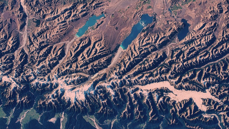
My research interests are in urban land change and natural disasters particularly landslide and flood. I like working mostly with optical remote sensing data to find out land change trends. I am also interested in cartography, machine learning, spatial data science and web GIS, basically just about anything that makes handling or understanding spatial data easier. I also love teaching concepts or just practical techniques on these subjects.
Whenever time permits, I like to play soccer, watch movies or edit some data on OSM.

GIS/Remote Sensing Engineer & Machine Learning Practictioner.
To secure a challenging role in computer vision, machine learning, and spatial data science with a dynamic team of professionals, leveraging my expertise to develop innovative solutions and drive growth in the field while enhancing my professional skills and career growth.
- Website: pratik-tan10.github.io
- City: Tuscaloosa, AL, USA
- Degree: Master
- Email: pdhungana@crimson.ua.edu
- Availability for work: Available
If you need help in mapping, spatial data analysis, machine learning, web development, data science, data analysis or computer vision, I might be able to help you.
Skills
I believe learning is a lifelong journey. I have gained strong skills in following topics through work experiences, courseworks, online courses, and personal projects.
Resume
Computer Vision, Machine Learning, and Spatial Data Science Expert Seeking Innovative Opportunities.
Sumary
Pratik Dhungana
Spatial Data Scientist and Computer Vision enthusiast with 6 years of experience, and expertise in Python, R, deep learning, and cloud services. Skilled in developing computer vision models, improving accuracy through data augmentation and tuning, and automating workflows. Proven track record of success in leading cross-functional teams and collaborating with stakeholders to deliver high-quality projects.
- Tuscaloosa, AL
- pdhungana@crimson.ua.edu
Education
MS in Geography: GIS & Remote Sensing Specialization
2021 - 2023
University of Alabama, Tuscaloosa, AL
Thesis: “Future Food, Energy, Water Trade-offs using Land Change Simulation: A Case Study of Alabama”
Class Projects:
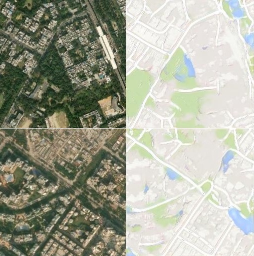
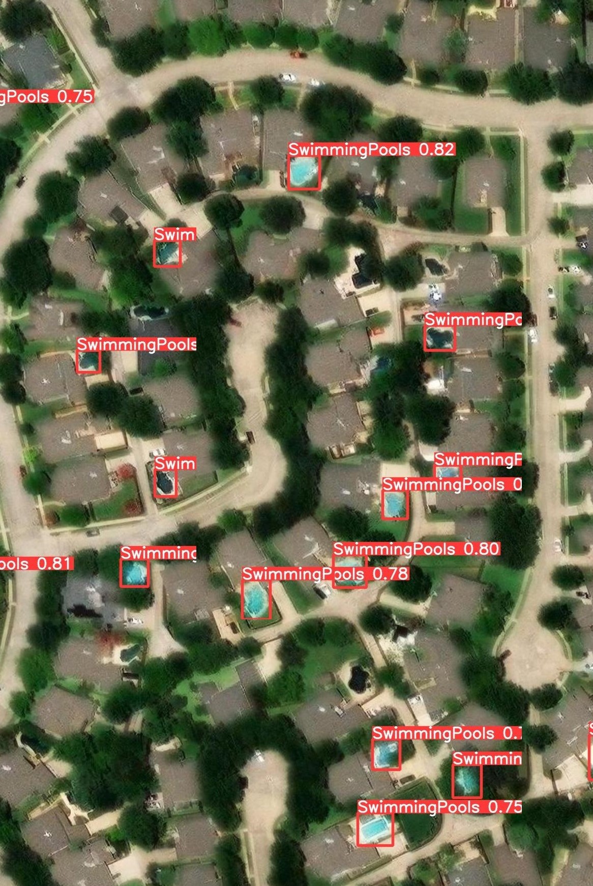
- Trained and deployed the YOLOv5 model for Swimming pool detection on Satellite Images using transfer learning.
- Implemented CLUE framework of land change modeling in python and used it to predict Future Land use of the State of Alabama.
- Identified significant factors affecting emigration rates of countries around the world using variable selection and significance testing.
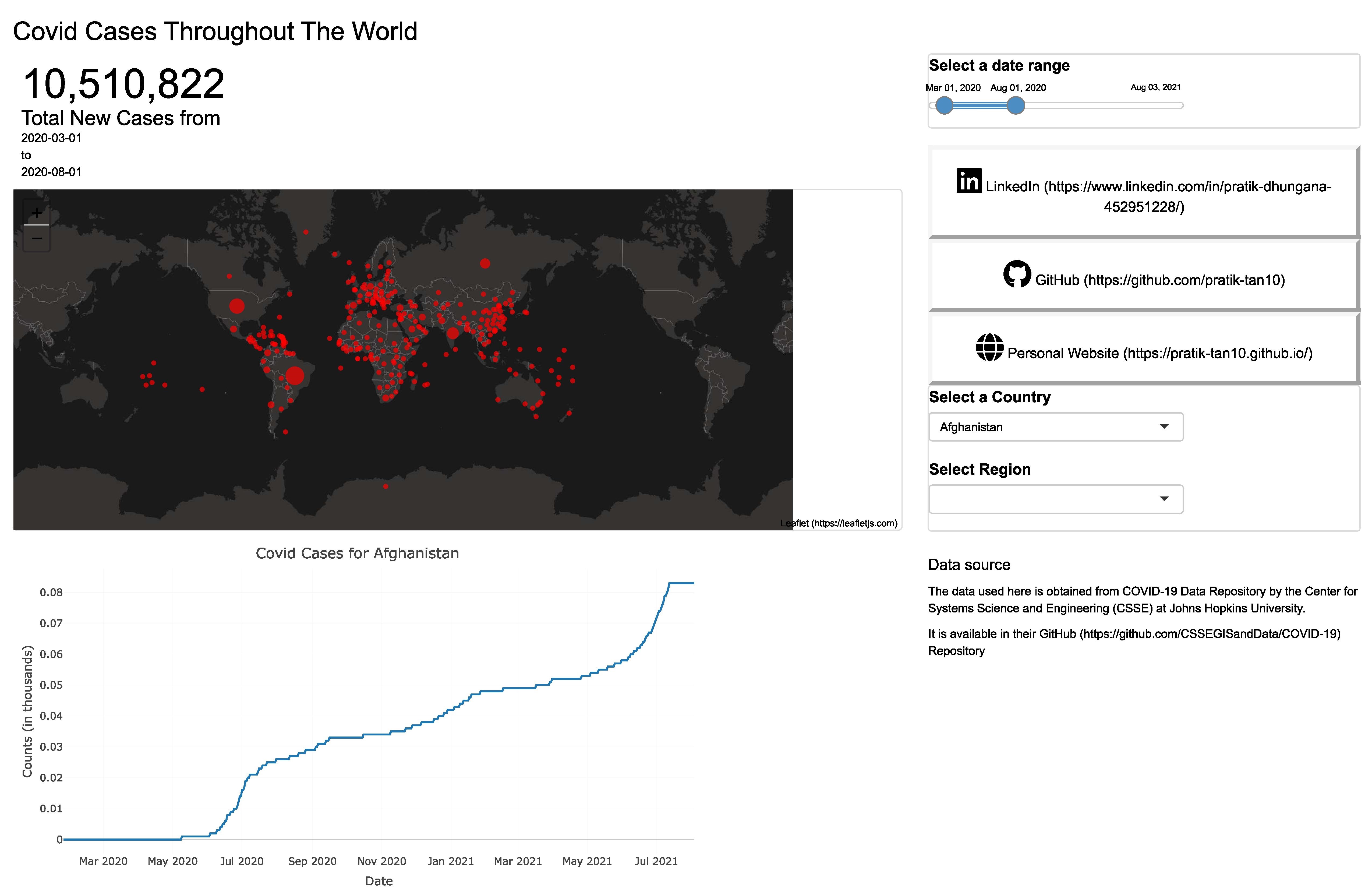
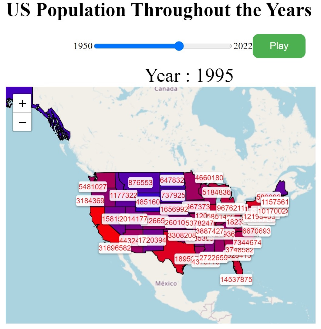
- Developed an interactive dashboard of population and population-density changes in Nepal in the last 5 decades.
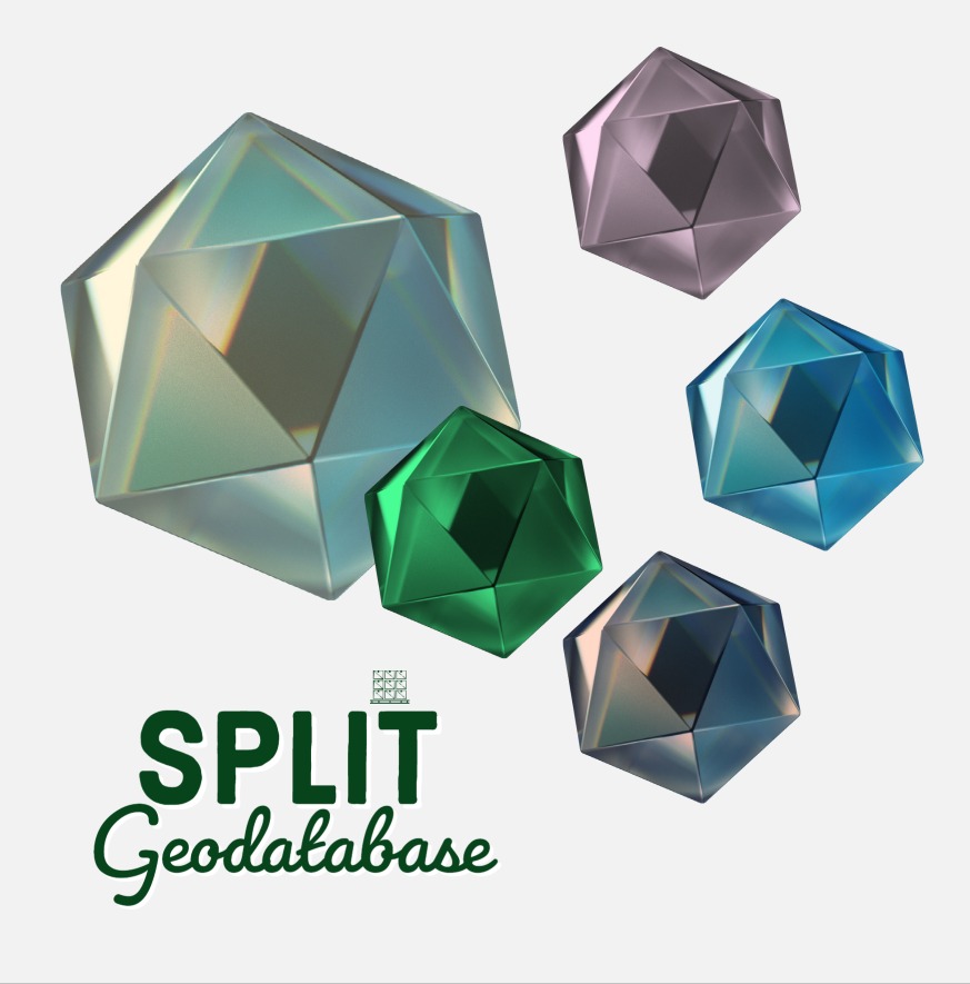
- Created ArcGIS Pro script tool for splitting geodatabase based on polygons of interest.
Bachelor in Geomatics Engineering
2013 - 2017
IOE Pashchimanchal Campus, Tribhuvan University, Pokhara, Nepal
Thesis: “Simulation of flood in Pokhara Valley Due to Seti River”
Class Projects:
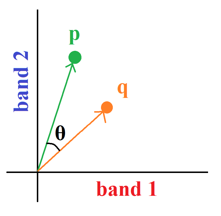
- Implemented the Spectral Angle Mapper algorithm in Python.
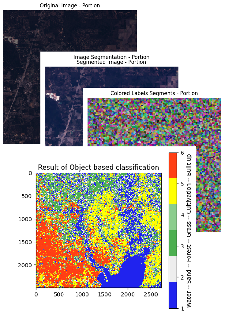
- Multispectral Satellite Image Semantic Segmentation Using Neural Network.
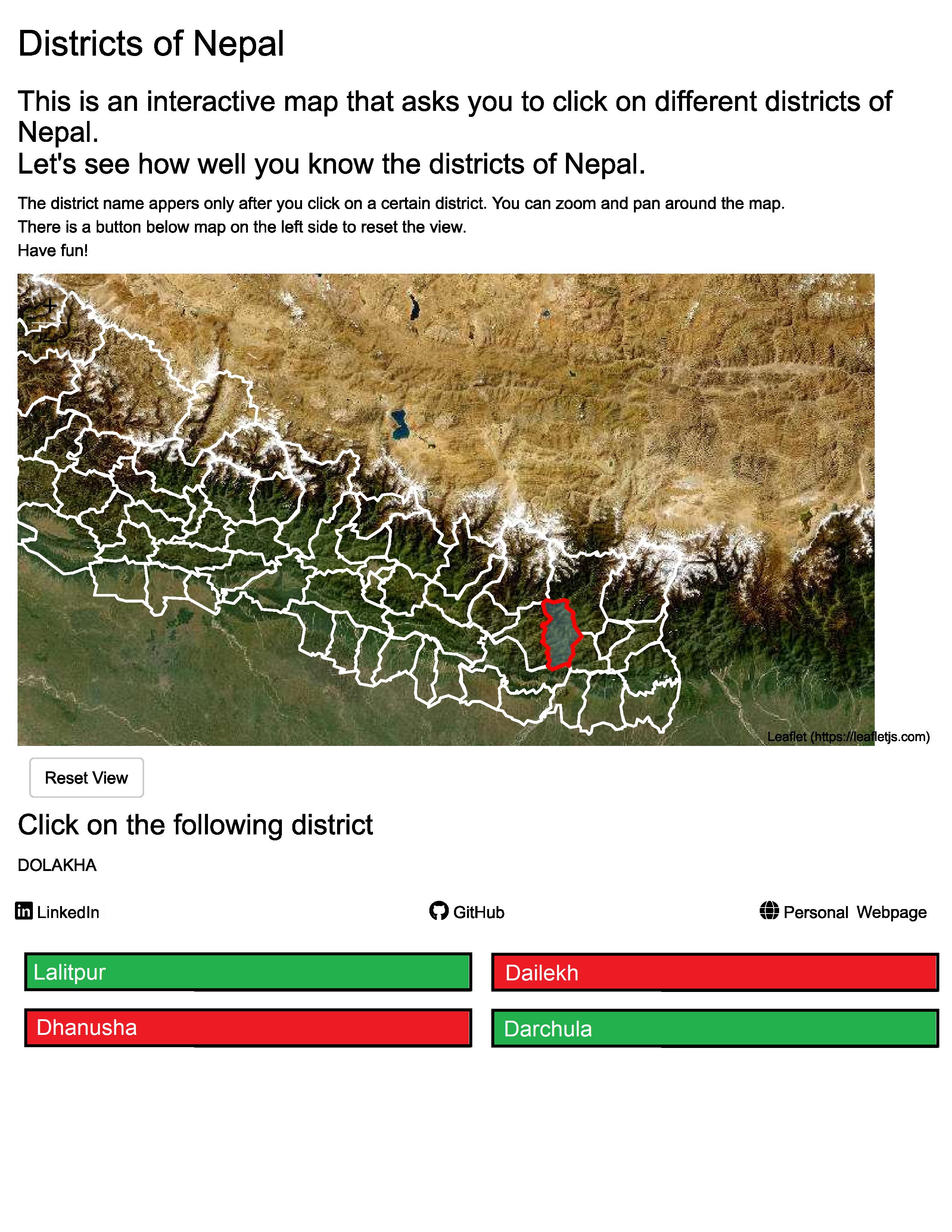
- Created an interactive web map of recreational places in and around Pokhara City.
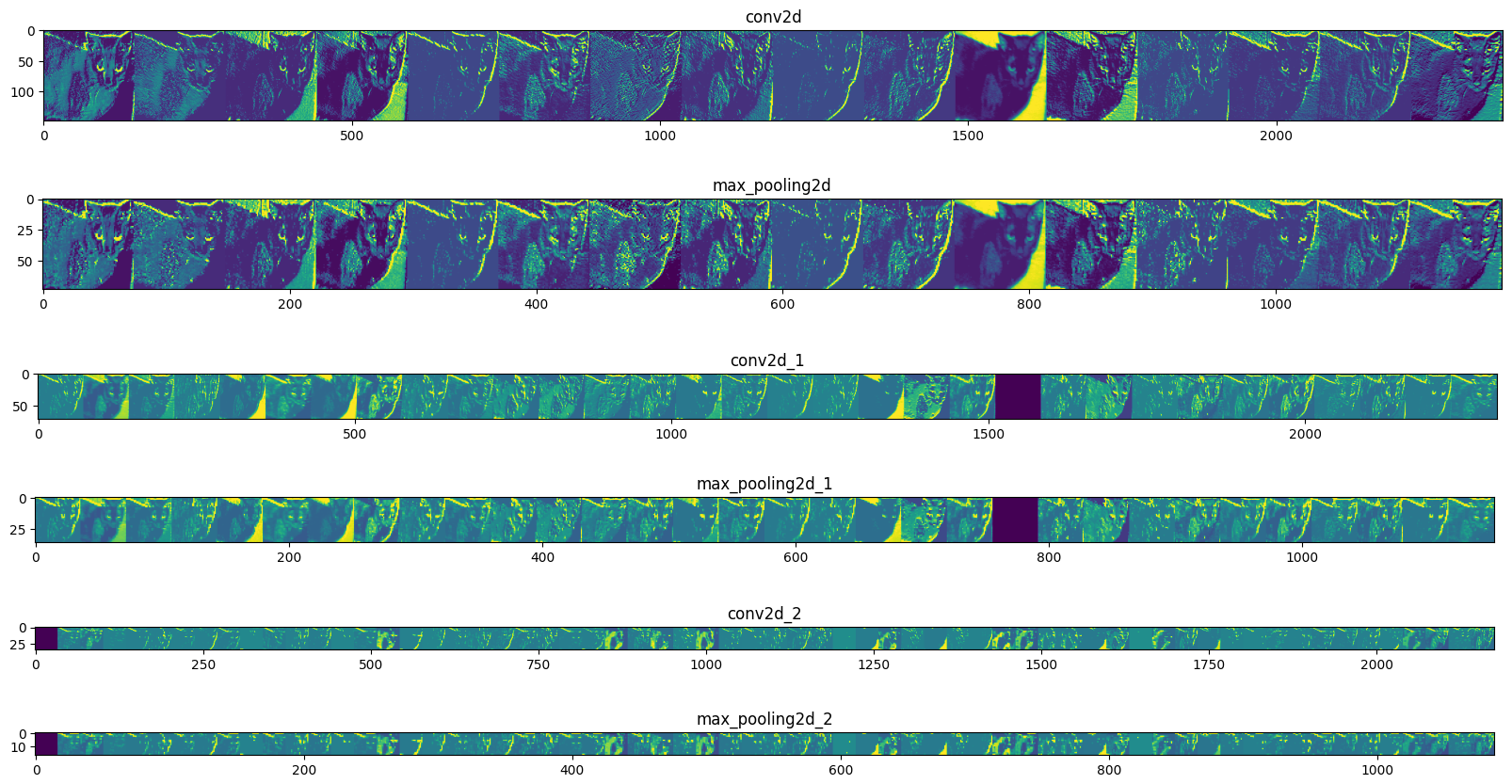
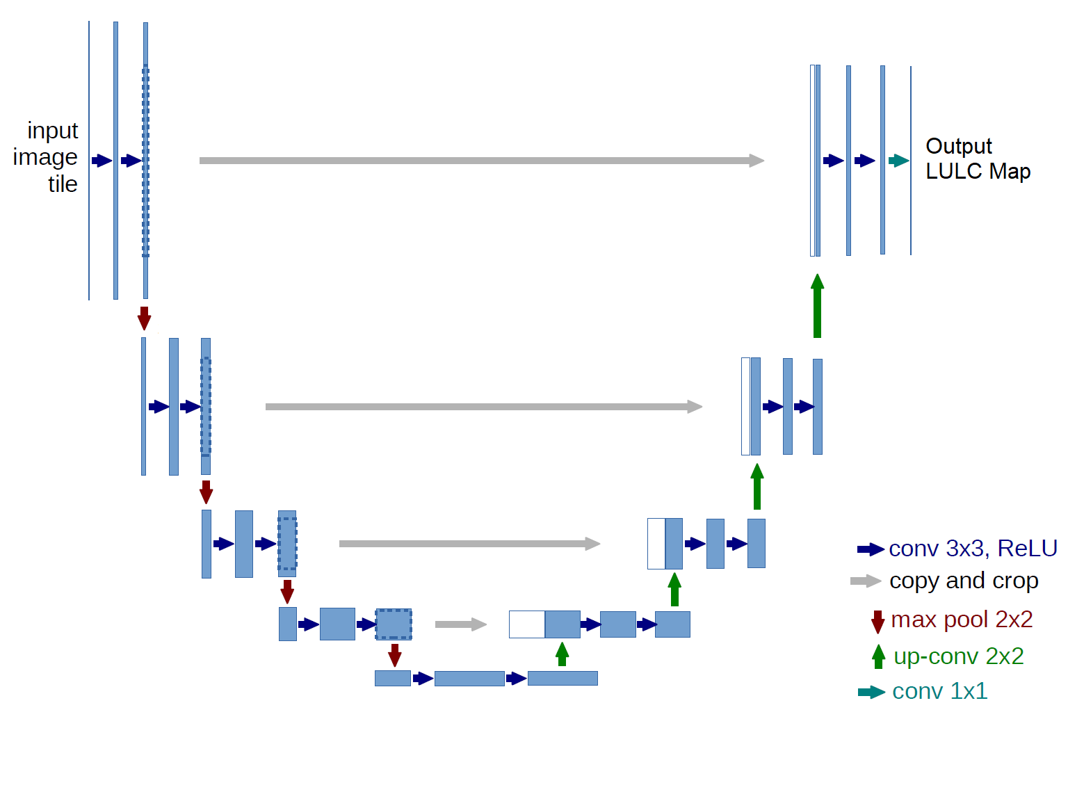
- Developed a building foot-print extraction model using U-Net.
- Analyzed the Spatio-temporal pattern of snow-cover changes in Nepal with cloud-based remote sensing.
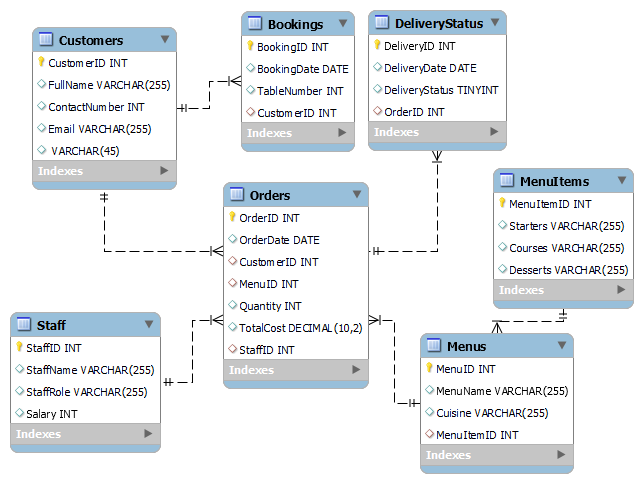
- Designed and developed the PostgreSQL database of the student records along with their spatial location information in PostGIS.
Machine Learning Projects
- Implemented an AWS-powered end-to-end data workflow project to detect potholes and illegal dumping using Rekognition, classify public sentiments using Comprehend, and send text alerts to corresponding teams using SNS with multi-level topics.
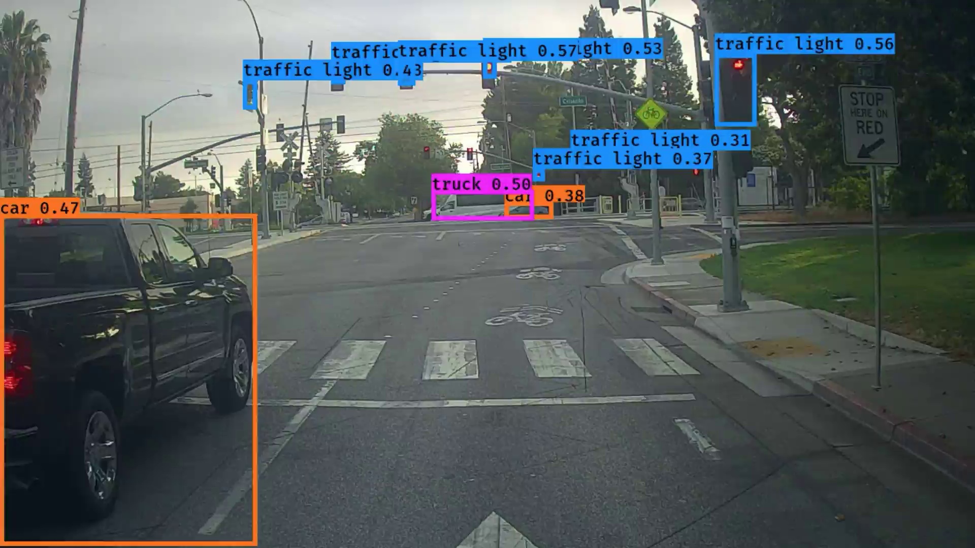
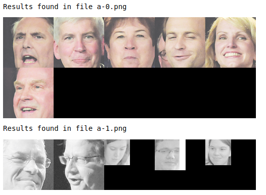
- Developed deep learning models for computer vision applications, including a U-net model for segmentation of street-view images, a multi-task learning neural network for road sign detection, a face verification and recognition system using Siamese Neural Network, and a lightweight model for dog species classification using MobileNetV2.
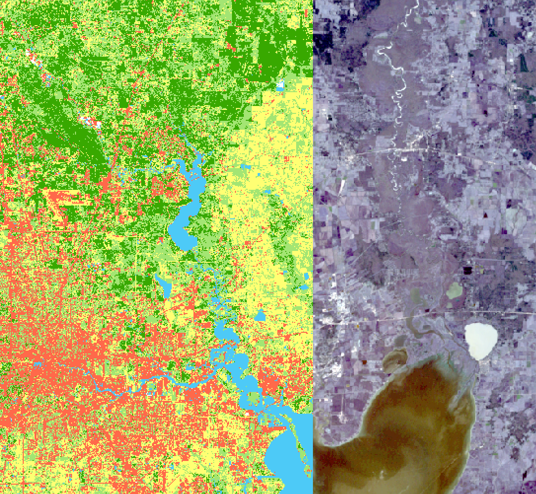
- Improved the accuracy of existing models for pixel-wise land use classification from the satellite image, bird detection on security camera footage, and movie recommendation systems by using data augmentation, bias-variance analysis, and hyper-parameter tuning.
- Modified and deployed the YOLOv5 model for swimming pool detection on satellite images.
- Built a sentiment detection model with LSTM and a word-level language model with RNN.
- Developed a flood vulnerability map using a random forest classifier on historical flood data, and applied an anomaly detection algorithm to detect failing servers on the network.
- Built a deep reinforcement learning model to train an agent to land a lunar lander safely on a landing pad on the surface of the moon, and a system to recommend video games based on k-mean clustering.
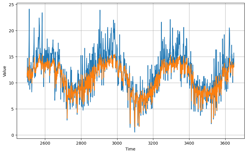
- Predicted dailiy minimum temperature in Melbourne using combination of LSTM and CNN, automated hyperparameter tuning using keras-tuner.
Professional Experience
Graduate Research/Teaching Assistant
2022 - 2023
The University of Alabama, Tuscaloosa, AL
- Developed ETL pipelines to run Python, R, and JavaScript scripts for accessing and preprocessing data and imageries from databases and web APIs.
- Executed machine learning on a cluster of computers for land change simulation and object detection using big remote sensing data as well automated hyperparameter tuning process.
- Taught spatiotemporal analysis and visualization of weather data to undergraduate students.
Survey Officer - GIS and Remote Sensing
2018 - 2021
Survey Department, Government of Nepal, Kathmandu, Nepal
- Led a team of 6 engineers in designing a national topographic database and automating the migration of data from older versions to newer versions; Created specifications for database, symbols, and map layout.
- Automated satellite image processing, GIS data preprocessing, analysis, and map production workflow to reduce 7 weeks of manual work for 48 people each year, Reconciled schema and domain conflict between past national land use databases.
- Provided monthly training on Remote Sensing, GIS, cartography, and data analysis as well as on custom tools to teams of up to 56 GIS professionals to help them adapt to the updated workflow.
- Led a team of national topographic database update program from planning to final database production with agile project management practice, performed quality control, and maintained meta-data for the produced data.
- Created deep learning models for land cover and land use segmentation from satellite images and parcel boundary detection in aerial photographs.
- Facilitated collaboration among representatives of several ministries of the Government of Nepal in the national topographic database update program.
- Improved the speed of analysis by conversion of tabular data and shapefiles into PostGIS database tables.
GIS Expert
2017 - 2018
ADMC Engineering Pvt. Ltd, Kathmandu, Nepal
- Reduced 50% data quality issues by integrating CAD, GIS, and tabular data into a unified geodatabase.
- Performed spatial and statistical analysis of land use data for 6 municipalities of Nepal.
- Prepared proposal drafts, and progress reports on 1 district-level land use mapping project and presented them in front of stakeholders.
- Collaborated with web developers to create databases, dashboards, maps, and the company's and client’s websites.
Publications
- Magliocca, N. R., Dhungana, P., & Sink, C. D. (2023). Review of counterfactual land change modeling for causal inference in land system science. Journal of Land Use Science, 18(1), 1-24.
Certificates
- TensorFlow Developer Certificate
- FAA Remote Pilot Certificate
- Google IT Support Professional Certificate
- Meta Database Engineer Professional Certificate (Ongoin)
- Deep Learning Specialization by DeepLearning.AI on Coursera
- Data Scientist with R career track on DataCamp with 22 courses
- JavaScript for Beginners Specialization by the University of California, Davis on Coursera
- SQL Server Developer
- SQL Server for Database Administrators
- SQL for Database Administrators
- Remote Sensing Image Acquisition, Analysis and Applications
- Spatial Data Science and Applications
Portfolio
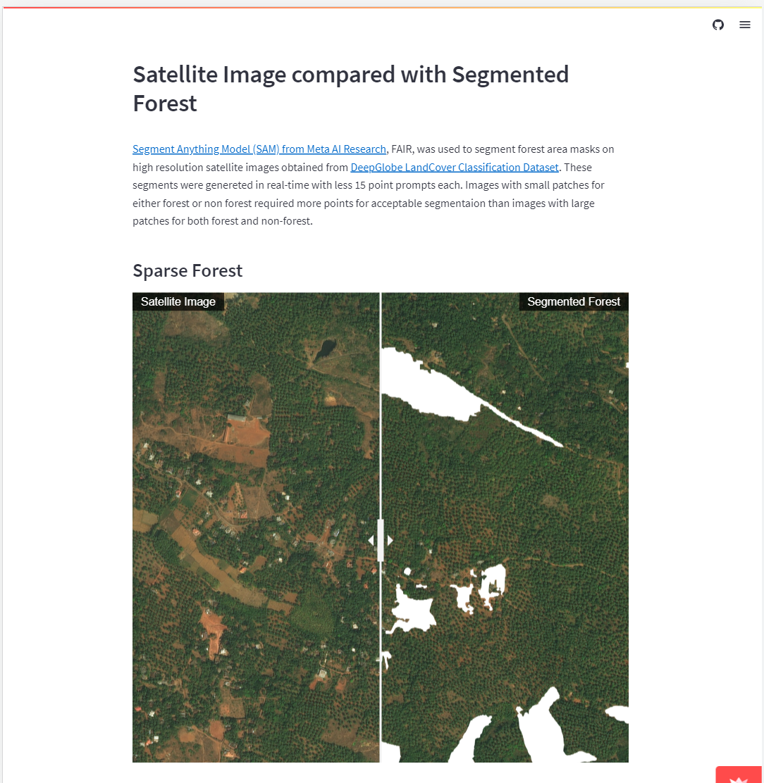
I have mostly worked in GIS and Remote Sensing, Software Development and Computer Vision. Though I am not allowed to share the work I have done for my organizations, here are some works I have done either for my class projects or for teaching my students.
- All
- GIS and Remote Sensing
- Software Developement
- Computer Vision
Contact
Location:
Tuscaloosa, AL, USA
Email:
pdhungana@crimson.ua.edu